 |

When a traveller in north central Massachusetts takes the wrong fork at the junction of the Aylesbury pike just beyond Dean’s Corners he comes upon a lonely and curious country... Without knowing why, one hesitates to ask directions from the gnarled, solitary figures spied now and then on crumbling doorsteps or on the sloping, rock-strown meadows. Those figures are so silent and furtive that one feels somehow confronted by forbidden things, with which it would be better to have nothing to do.
—H. P. Lovecraft, "The Dunwich Horror"
The geography of Dunwich is much less well-defined than that of Arkham or Innsmouth. So far as I can determine, there are no surviving sketch-maps of Dunwich by H. P. Lovecraft himself. We are left to fall back solely on the descriptions in the story "The Dunwich Horror" itself. The story abounds with references to eldritch places like Sentinel Hill, Devil's Hop Yard, and the dark and creepy Cold Spring Glen, home of soul-stealing whippoorwills. And the plot involves the characters moving about among these places and encountering them in a particular order. However, there are few references to compass directions, or even to relative directions such as whether the characters make a right or left turn as they proceed. As a result, there are many possible layouts of the Dunwich area that could be reconciled with the text. The map that I have prepared below is one such interpretation. It is my hope that this plan will help some readers visualize the story's comings and goings a little more easily.

Location
Regarding the general location, the opening sentence tells us that Dunwich is in "north central Massachusetts". Similarly, in a letter, HPL stated that "the scene is in the upper Miskatonic Valley—far, far west of Arkham" [1].
On the other hand, Dunwich is supposedly closer to the Miskatonic University (in Arkham) than it is to the Widener Library (at Harvard University, in a suburb of Boston).
Correspondence with the Widener Library at Harvard, the Bibliothèque Nationale in Paris, the British Museum, the University of Buenos Ayres, and the Library of Miskatonic University of Arkham had failed to get [Wilbur Whately] the loan of a book he desperately wanted; so at length he set out in person . . . to consult the copy at Miskatonic, which was the nearest to him geographically. —HPL Dunwich (online text)
The problem is that Arkham and Boston are both in Essex County, the most northeastern country in Massachusetts, and Arkham is further east than Boston. As a result, any place in north central Massachusetts would really be closer to Boston than to Arkham. It seems that either Wilbur Whateley or the narrator is not very good at calculating distances. Perhaps Wilbur really chose the Miskatonic because it is a simpler drive; he could follow the Aylesbury Pike the whole way to Arkham, and could avoid the confusing urban sprawl of the Boston area.
Aylesbury Pike
The story begins by describing a typical traveler on the Aylesbury Pike in north central Massachusetts, who takes a wrong turn at a junction "just beyond Dean's Corners" and inadvertantly follows a side road through Dunwich. The traveler is finally relieved "to get clear of the place, and to follow the narrow road around the base of the hills and across the level country beyond till it rejoins the Aylesbury pike."
The first question, then, concerns the course of the Aylesbury Pike. We can infer that the overall trend is east-west, because the Pike runs between north central Massachusetts and Arkham, which is in Essex County in northeastern Massachusetts.
Note that Lovecraft does not specify whether the prototypical traveler is headed west or east. I prefer to think that he is heading west from Arkham, because the most momentous journeys in the story are between Arkham and Dunwich, and Arkham is the psychological center of Lovecraft's imaginary New England. According to this interpretation, Dean's Corners is located on the Aylesbury Pike a bit to the east of the junction with the Dunwich road.
By the way, I had wondered what sort of thing "Dean's Corners" was supposed to be: a town, or some sort of geologic feature? Some Googling revealed the existence of various towns in the U.S. with "Corners" in the name. It seems to have been a convention to refer to a small rural town as "something corners" if it were located at the junction of several significant roads. (An example is Seven Corners, Virginia.) However, Dean's Corners can't be much of a town, since Wilbur Whateley had to go to Aylesbury to find a doctor when Old Whateley was dying.
While Aylesbury is presumably located on the Aylesbury Pike somewhere, the story doesn't specify whether Aylesbury is to the west or east of Dean's Corners. It is perhaps suggestive that "Earl Sawyer suggested that help be asked from Aylesbury or Arkham..." Since Aylesbury and Arkham are mentioned as alternatives, it seems natural that they be located in opposite directions. Since Arkham is to the east, I tend to interpret Aylesbury as being located to the west.
Miskatonic River
As the traveler proceeds on the Dunwich road, he sees "the thin, shining line of the Miskatonic’s upper reaches." We can infer an overall west-east trend for this river since it eventually reaches Arkham and the coast in Essex County. (An unsolved mystery is how the Miskatonic River manages to flow from north central Massachusetts to the coast of Essex County without being being diverted by the other rivers that cross its path: the Nashua, Concord, and Merrimac. Evidently some sort of non-Euclidean geometry is involved.) In any case, the river "has an oddly serpent-like suggestion as it winds close to the feet of the domed hills among which it rises," so we must bear in mind that in the vicinity of Dunwich the river's course might not be directly west to east.
The question arises whether the Aylesbury Pike runs south or north of the Miskatonic River. In Lovecraft's map of Arkham, Aylesbury Street exits the west side of town just south of the river. Although the Aylesbury Pike could cross and recross the river many times on bridges, it takes work to build bridges. The simplest assumption is that the Aylesbury Pike tends to run south of the river.
The story tells us that "across a covered bridge one sees a small village huddled between the stream and the vertical slope of Round Mountain..." Since the Miskatonic was just mentioned three sentences previously, and no other rivers or streams have been mentioned, it appears that Dunwich village is beside the Miskatonic. Now, if the Miskatonic runs north of the Aylesbury Pike, and the Dunwich road leaves the Aylesbury Pike and crosses a bridge over the Miskatonic before reaching Dunwich, then it appears that Dunwich is on the north side of the river. So a rough sketch of the area would look something like this:

Dunwich Village
The story tells us little of the geography of the village itself. We are told that the buildings are generally ancient and decrepit, and there is a "faint, malign odour." The only specific building mentioned is the broken-steepled former church building which houses Osborn's general store, "the one slovenly mercantile establishment of the hamlet." Also, "south of the village one may still spy the cellar walls and chimney of the ancient Bishop house, which was built before 1700." This feature is marked on our map as the "Bishop ruins."
The story also mentions "the ruins of the mill at the falls, built in 1806." The falls could be upstream or downstream from Dunwich, but I have placed them upstream, since that direction is closed to the river's origins among the hills, where falls would be expected to be more common. The mill itself should be slightly downstream from the falls, because typically a wooden water chute leads from the top of a falls to the top of a mill's water wheel, so the water can fall steeply downward to maximumize the force that turns the wheel. This assumption is also reflected in our map.

Doomed Farms
So far, we have pictured the river, the village, and Round Mountain, but most of the story's action takes place outside the village, amongst various country roads and hills in the general area of the Whateley farm. Since the village is "huddled between the stream" to the south and "the vertical slope of Round Mountain" to the north, there doesn't seem to be sufficient space for the rural Whately area either north or south of Dunwich village. It seems more likely that this area is located to the east or west of this village.
There is another faint hint; towards the end of the story, when Armitage and his cohorts are waiting at the Frye farm, they see "heavier and heavier clouds . . . piling themselves up beyond the hills to the northwest." From a purely emotional standpoint, this lends an ominous quality to the northwestern hills, and so it feels natural that Sentinel Hill should be among them. Anyway, for better or worse, I have placed the Whateley and Sentinel Hill area to the west and northwest of the village.
Once the Dunwich Horror escapes, much of the story's action lies along a road out of Dunwich, which passes a series of landmarks: the Corey farm (at a junction), the western mouth of Cold Spring Glen, Bishop's Brook, the Bishop farm, the Whateley farm, and then Sentinel Hill. As the characters traipse back and forth on the road, these landmarks are encountered in a consistent order. At least part of this road (near the mouth of Cold Spring Glen) is referred to as Spring Glen Road. A section further along, between the Bishop farm and the Whateley farm, is referred to as the "upper road."
Cold Spring Glen and the Shortcut
The doomed Frye farm is located "on the eastern edge of Cold Spring Glen." The farm is also said to be at "at the head of the glen." On the other hand, near Spring Glen Road is "the mouth of the glen, opposite side from the Fryes." So it seems that Cold Spring runs through this deep glen from east to west. An oddity is that Cold Spring flows from east to west, but presumably drains at some point into the Miskatonic, which flows from west to east. Of course, it's a hilly area and the local streams probably follow some circuitous paths. The Charles River in Massachusetts is an example of a waterway that nearly reverses direction more than once.
The Frye farm itself is clearly not on the same road as the Bishop farm or the Whateley farm. We learn this because Armitage requests a cross-country shortcut from the Frye farm to the Bishop farm, and Earl Sawyer suggests "cuttin’ acrost the lower medder here, wadin’ the brook at the low place, an’ climbin’ through Carrier’s mowin’ and the timber-lot beyont. That comes aout on the upper rud mighty nigh Seth’s—a leetle t’other side." Since "the Coreys live down by the junction" of Spring Glen Road and some other road, I have assumed that it is this second road that runs up to the Frye farm.
It is evident that Earl Sawyer's shortcut roughly parallels Cold Spring Glen, but a bit to the north, since it reaches the "upper road" portion of Spring Glen Road a bit beyond the Bishop farm. Towards the beginning of the shortcut, the heroes have to ford a small brook, and I have interpreted this as part of Bishop's Brook.

Sally Sawyer comments on two sites that are close to Cold Spring Glen: "I allus says Col’ Spring Glen ain’t no healthy nor decent place. The whippoorwills an’ fireflies there never did act like they was creaters o’ Gawd, an’ they’s them as says ye kin hear strange things a-rushin’ an’ a-talkin’ in the air daown thar ef ye stand in the right place, atween the rock falls an’ Bear’s Den." Since Cold Spring, being a spring, by definition springs from the ground at its source, I have speculated that Rock Falls are at the head of the glen and are the source of Cold Spring. If Bear's Den is at the opposite end, near the mouth of the glen, then anyone standing between Rock Falls and Bear's Den would be alongside some part of Cold Spring Glen and could hear any "strange things a-rushin' an' a-talkin'" down in the glen.
Meadows, Pastures, and a Hop-Yard
Ten-Acre Meadow is presumably someplace convenient to the Corey farm, since Corey’s hired boy Luther Brown makes a habitual "morning trip to Ten-Acre Meadow with the cows." Also, Luther is driving in the cows (from Ten-Acre Meadow, presumably) when he "sees the trees bending at the mouth of the glen." This suggests that Ten-Acre Meadow is between the Corey farm and the mouth of the glen.

The Upper Pasture and Devil's Hop-Yard are evidently somewhere near the Bishop farm, since Chauncey Sawyer "sot to look fer Seth’s caows, frighted ez he was; an’ faound ‘em in the upper pasture nigh the Devil’s Hop Yard in an awful shape." Presumably the upper pasture is also close to the Whateley farm, since these were the first cows that the Dunwich Horror found to eat after bursting forth from the Whateley farmhouse. Initially, I assumed that the pasture, upper pasture, and Devil's Hop-Yard were all east and northeast of the Bishop farm; however, that arrangement doesn't work, for two reasons: (1) in travelling from the pasture to Cold Spring Glen, the Horror would have had no reason to go down Spring Glen Road; it could have proceeded more directly across the countryside, and (2) the Horror would have left tracks, and the professors would have crossed its tracks when they take their cross-country shortcut later in the story; but there is no mention of their crossing its tracks. These problems are avoided by placing the pasture, upper pasture, and Devil's Hop-Yard off to the west and northwest of the Bishop farm. In heading from the pasture to Cold Spring Glen, the horror naturally encounters Spring Glen Road and follows it a ways until the road passes by the mouth of the glen.

Now we shall chart the characters' movements on this proposed map over the course of the story.
Sunday Night, Sept 9/10
The horror breaks loose from the Whateley farmhouse, leaving it "all blowed up, with the timbers scattered raound like they’d ben dynamite inside." It leaves great tracks leading "off into the medders."
The horror then attacks Seth Bishop's cattle in their pasture. The remaining cattle flee to the upper pasture. The horror leaves further tracks "towards the glen rud to the village" and then more "prints in the rud" that finally "go into the glen itself."

Monday Morning, Sept 10
Chauncey Sawyer is the first to discover signs of the horror's escape. Chauncey's movements are later described in a somewhat muddled and inconsistent way by his mother, Sally Sawyer, the housekeeper at the Bishop farm. Apparently Chauncey goes "on the hill toward Whateley’s" and sees the destroyed Whateley farmhouse and "the pasturage where Mr. Bishop’s cows had been left out all night." Then Chauncey goes to look for Seth's caows, despite his great fright, and finds them "in the upper pasture nigh the Devil’s Hop Yard in an awful shape." Chauncey comes running back and can't "haff talk fer bein’ scairt!"
Luther Brown, the hired boy at George Corey’s, takes the cows on his morning trip to Ten-Acre Meadow, and sees the horror's tracks on Spring Glen Road beyond the glen. Luther rushes frenziedly back to the farm along with the "no less frightened herd" and stammers out his tale to Mrs. Corey.

Monday Night, Sept 10/11
At 2am, the Dunwich Horror kills the cows in the barn at Elmer Frye's, on the eastern edge of Cold Spring Glen, then returns to the glen. Afterwards, "Two titan swaths of destruction stretched from the glen to the Frye farmyard, monstrous prints covered the bare patches of ground, and one side of the old red barn had completely caved in."

Tuesday Night, Sept 11/12
Nothing occurs "except some hill noises."
Wednesday Night Sept 12/13
The horror visits Sentinel Hill, leaving "a fresh set of the monstrous tracks in the road skirting Sentinel Hill" and "a thirty-foot swath of crushed shrubbery saplings" leading steeply up the hill. On the summit, the horror thrashes "a vast space" and leaves "a thick and foetid deposit of the same tarry stickiness" on the altar table. The horror returns to Cold Spring Glen "along the same path."

Thursday Night, Sept 13/14
The Dunwich Horror emerges from the glen, leaving "more swaths and monstrous prints" on the way to the Frye farmhouse, which it destroys before returning to the glen.

Friday Afternoon, Sept 14
The professors arrive in Dunwich at 1 pm and visit Osborn's store. They spend the afternoon driving around the area, and viewing "the drear Frye ruins with their lingering traces of the tarry stickiness, the blasphemous tracks in the Frye yard, the wounded Seth Bishop cattle, and the enormous swaths of disturbed vegetation in various places," as well as the "trail up and down Sentinel Hill" and "the sinister altar-like stone on the summit." Then they return to the Frye farm, looking for the missing party of State Police. Most of their movements are probably along Spring Glen Road and the other road that leads from junction at the Corey farmhouse to the Frye farm.

Friday Night, Sept 14/15
The professors wait at the Frye farm ruins near Cold Spring Glen.
Saturday Daytime, Sept 15
Luther Brown is out (probably at Ten-Acre Meadow), "drivin’ in the caows from the storm arter the big bolt, when he see all the trees a-bendin’ at the maouth o’ the glen . . . an’ [smells] the same awful smell like he smelt when he faound the big tracks las’ Monday mornin’." Then he sees signs of the horror moving along Spring Glen Road: "all on a suddent the trees along the rud begun ter git pushed one side, an’ they was a awful stompin’ an’ splashin’ in the mud."
Then, "fur ahead where Bishop’s Brook goes under the rud" he hears "a awful creakin’ an’ strainin’ on the bridge, an’ says he could tell the saound o’ wood a-startin’ to crack an’ split." Then "the swishin’ saound" continues "on the rud towards Wizard Whateley’s an’ Sentinel Hill." Along the way, it stops to obliterate the Bishop farmhouse and the family inside.
The professors and their entourage of locals take a cross country shortcut from the Frye farm to the Bishop farmhouse "acrost the lower medder here, wadin’ the brook at the low place, an’ climbin’ through Carrier’s mowin’ and the timber-lot beyont." By the way, Collin's English Dictionary defines "mowing" as "a field on which grass is grown for hay."
Toward the end of their shorcut, they climb over an "almost perpendicular wooded hill . . . among whose fantastic ancient trees they had to scramble as if up a ladder". Then they come out "on the upper rud mighty nigh Seth’s—a leetle t’other side."
They follow the road "just around the bend" to briefly survey the Bishop ruins, then reverse direction to follow the horror towards Sentinel Hill. They see where the horror's tracks leave the road, then through their telescope, see signs that the horror is ascending Sentinel Hill. The professors ascend the mountain alone, leaving "the telescope with the frightened group that remained in the road."

Conclusion
As mentioned at the beginning of this article, the geography of the Dunwich area is vaguely defined and subject to multiple interpretations. But I hope that I have shown that this map gives a plausible arrangement, and one that is consistent with the action in the story.
For those who are interested in different interpretations,
- The H. P. Lovecraft Historical Society "radio" dramatization of The Dunwich Horror comes with a very attractive and atmospheric map. Their dramatization is also worth listening to, with some quaint New England accents and a fine performance by Gary Ballard as Wizard Whateley.
- Dunwich Village and Environs, by Jamie Bruce (RykerWulf) on DeviantArt, is a thoughfully considered and attractively drawn map.
- French artist and cartographer Laurent Gontier has discovered an area in north-central Massachusetts where the topography parallels Lovecraft's tale rather closely, and is working on an exquisitely rendered Dunwich map that fills in details taken from that locale. For further information on Gontier's work, see his website at https://www.laurentgontier.com/.
Footnotes
1. Lovecraft to James F. Morton, June 1928, in Selected Letters 1925-1929; Sauk City, Wisc: Arkham House, 1968.
Return to Cthulhu Files home page
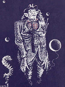
Top portrait of Wilbur Whateley is by Lee Brown Coye, from the cover of H. P. Lovecraft, The Dunwich Horror and Others.
Send comments to jfm.baharna@gmail.com.
© Copyright 2023 by Joseph Morales.